Shirt of two halves
-
Posts
2 -
Joined
-
Last visited
Content Type
Profiles
Forums
Uncouth Garb - The BRFCS Store
Everything posted by Shirt of two halves
-
Where are Rovers old grounds?
Shirt of two halves replied to StubbsUK's topic in Blackburn Rovers Fans Messageboard
From the Borough of Blackburn ‘Plan of Land’ dated 1882, the ‘footprint’ of the Baptist Church together with other land up to the back of the Leamington Pub and the backs of the terraced houses on Cheltenham Street does form part of the total land purchased by the Rovers. I do believe though that as shown in the artists’ sketch it remained outside of the perimeter fence and gates of the actual football ground. Revidge Blue alludes to the need for crowd management and a large spacious area outside the gates as a form of forecourt would have helped facilitate the entry and egress of the supporters. It might also have been used as a horse ‘n’ cart park. From the Northern Daily Telegraph report in April 1893 I’d also be interested to know where Wellington Road is in the area. -
Where are Rovers old grounds?
Shirt of two halves replied to StubbsUK's topic in Blackburn Rovers Fans Messageboard
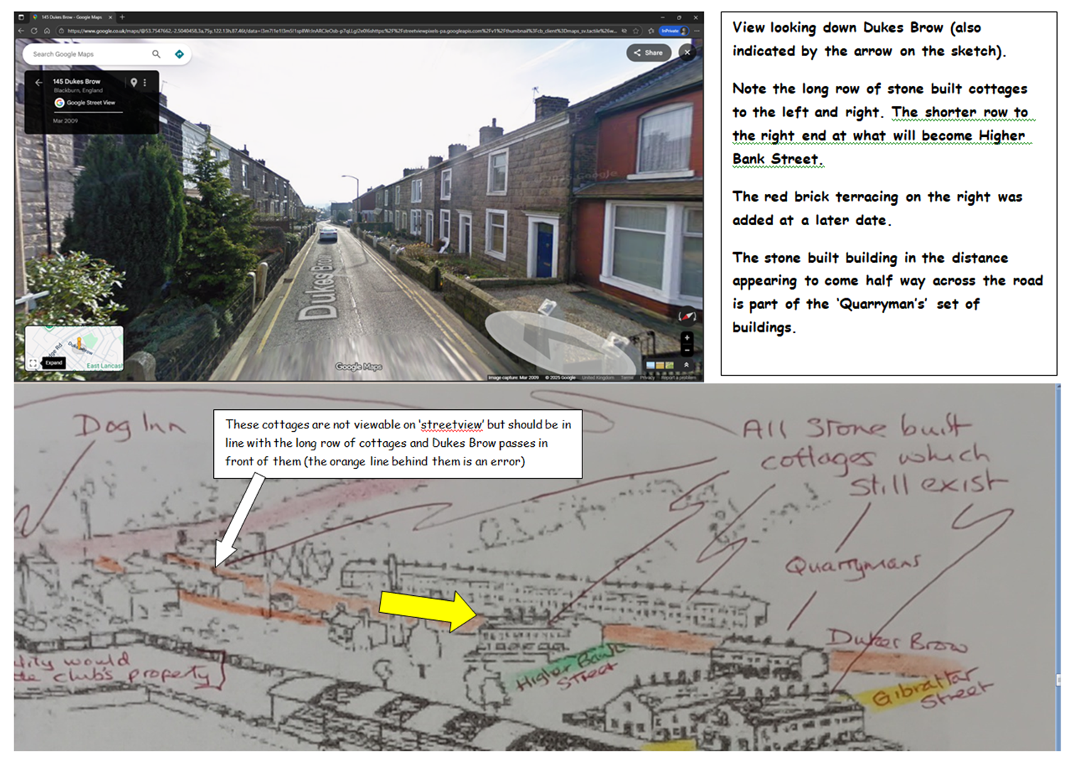
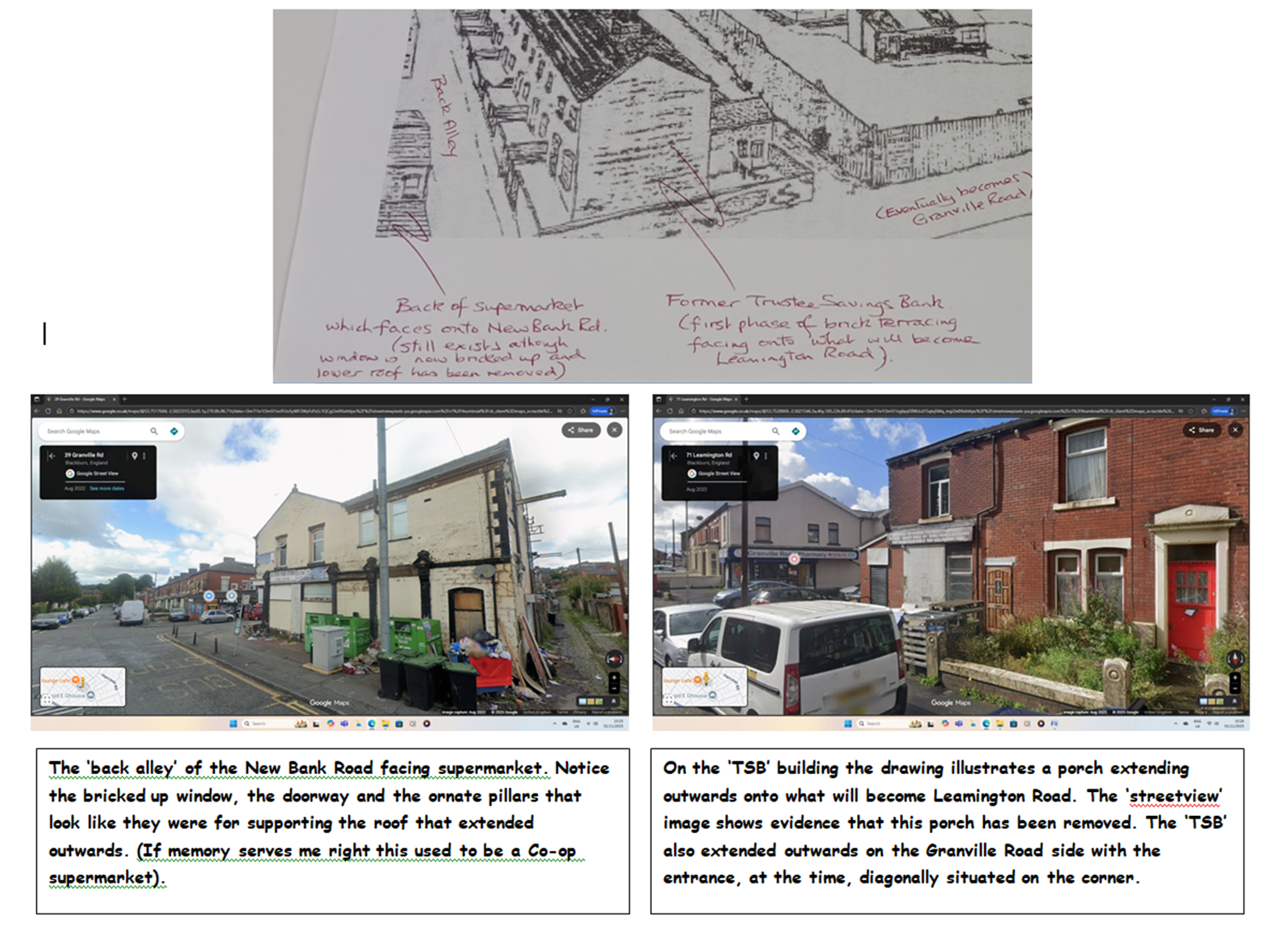
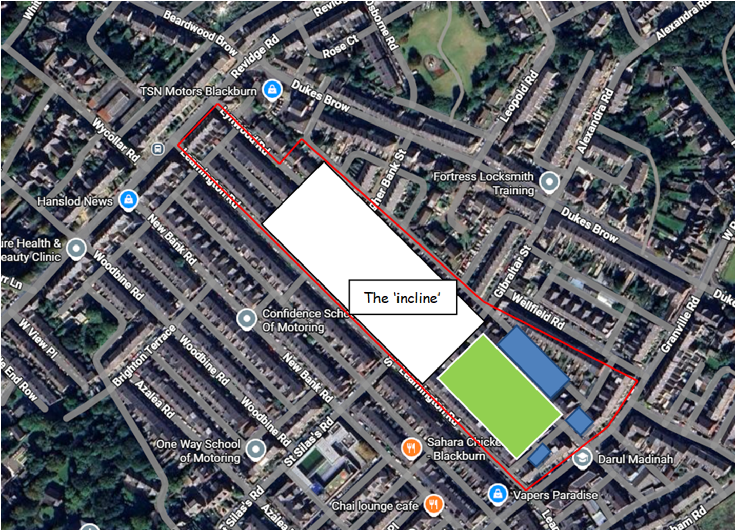
Wishing the Rovers and fans a happy anniversary on this momentous day in our history. Rovers at Leamington Street The artist clearly focussed his/her attention on the immediate foreground and facilities around the pitch. However at some expense of scale, relative distance and perspective he/she still managed to squeeze into the background of their picture many excellent details and clues that we can cross reference to locate, fairly well, the Leamington Street ground. Depicting the ‘incline’ obviously proved difficult in the space left on his/her paper. I was also intrigued to locate the apparently elevated position of the artist and I think the rear upstairs window of the Leamington pub on Cheltenham Street is a fair contender. My own ‘graphical’ observations I have included for further consideration and debate although many of us are clearly having a ‘meeting of minds’. I am also fascinated to know how far back towards the Dog Inn the crowd could go and still have a reasonable view of the pitch. With respect and apologies to Simon Garners 194 quoted reference, most of us locals have dismissed those proposals as totally unrealistic. Revidge road and surrounding ‘ridge’ area is built on solid rock evidenced by the numerous quarries in the area, the outcrops in Corporation Park (of which I’ve climbed them all) and the inscribed semi circular commemorative stone for the cutting of the road at ‘Mount Pleasant’ in 1826 located just a little west of the former Corporation pub. To excavate the area needed for a level football ground was just not feasible in terms of practicalities and prohibitive costs. Neither would using ‘infill’ to level up be a viable solution. No physical evidence for either of these concepts actually being done are in existence. The maps I have referenced include those surveyed in 1844-5 and 1892, but the ‘Plan of Land’ dated 1882 is the one that indicates ‘the blank canvas’ available for the Rovers at the outset with the exception of ‘the incline’. By the time the artist produced his/her work terraces were being built in the surrounding vicinity and when the Rovers finally vacated the site the 1892 survey shows that the ground was already being built upon.